Gore Mountain Real Estate
![]() of the Adirondack Park
of the Adirondack Park
![]()
North Creek
![]() Saranac Lake
Saranac Lake
Sandi Engle-Pratt, Realtor, Broker-Owner &
Carolyn Hutchins, Associate Broker & Ron Philpott, Salesperson
![]()
![]()
![]()
![]()
![]()
![]()
![]()
![]()
![]()
![]()
![]()
![]()
![]()
![]()
![]()
![]()
![]()
![]()
![]()
![]()
![]()
![]()
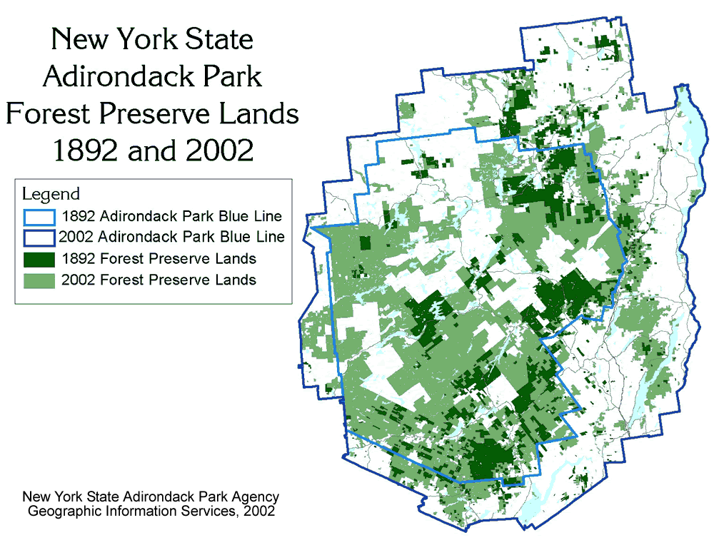
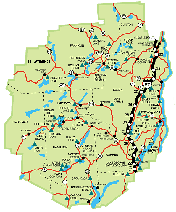
ADIRONDACK MAPS and More!!!
|
Adirondack Park Interactive Map brought to you by the Adirondack Regional Tourism Council |
Adirondack Park Campsite Map brought to you by NYS DEC |
Google Earth users download
Blueline.kml
(73kb)* to see the Adirondack Park "blueline" (park boundry) area within Google Earth.
This boundary file should not be used for legal jurisdictional determinations.
Save the kml file to your disk, start Google Earth, choose File>Open and open the blueline.kml file . * Blueline.kml provided by NYS Adirondack Park Agency. |
|
Brant Lake Information |
Friends Lake Information |
Loon Lake Information |
|
Schroon Lake Information |
|
|
Hope this page was usefull!!!
295 Main Street
PO Box 323
North Creek NY 12853
Office (518) 251-5111
email: info@goremtnrealestate.comAll images and content are copy write protected and can not be used without the expressed consent of Gore Mountain Real Estate.
The information presented is believed accurate, but not guaranteed by the broker.
